Satellite Mapping Features on Exactix
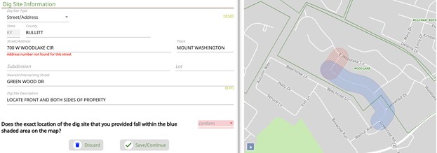
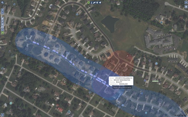
When Exactix launches on the night of March 31, new mapping technology will be available that will benefit locators, excavators and members. The new satellite mapping feature allows users to switch between a street and aerial view of the base map.
All map features are available on both map views, so users are able to manually select the dig site within the aerial view. When an address is not found in the system, the aerial view allows users to see satellite imagery of the area they are planning to dig to ensure the correct area is located.
Learn More About Mapping Features
For more information, please view our ticket creation tips for existing account users.
Exactix will launch the night of March 31. If you have any questions, please contact our Exactix Launch team at [email protected]. Please visit indiana811.org/exactix for more details about Indiana 811’s ticketing platform.